Skip to content
Peakyas
EN
Mont Narodnaïa

Mountain·RussiaRussia

Mount Narodnaya

1,895m

Ural Mountains

Summit weather

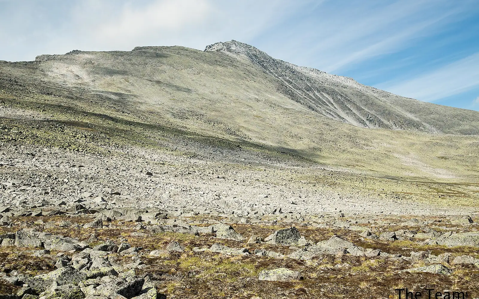
The Good Team · CC BY-SA 4.0 · Wikimedia Commons

Elevation
1,895m
Prominence
1,772m
Isolation
1,836km
Relief
1,150mabove the lowest point within 5 km
Steepest slope
56°within 1 km of the summit
Snow at the summit
All yearSee month by month ↓
First ascent
1929
Summit
65.0350°N, 60.1139°E

Mountain in Russia

Mount Narodnaya is a mountain in the Ural Mountains (Russia). Its summit stands 1,895 m above sea level. Its prominence — how far it rises above the highest saddle linking it to a taller summit — is 1,772 m, and the nearest higher ground is 1,836 km away. It was first climbed in 1929.

From the lowest point within 5 km (745 m), it rises 1,150 m. The steepest side is the south-west face: 34° on average over the first kilometre. In places the ground near the top reaches 56° — terrain for climbers, not walkers.

Mount Narodnaya (Gora Narodnaya) is the highest summit of the Ural Mountains, at 1,895 m. It stands in the Subpolar Urals on the boundary between the Komi Republic and Khanty-Mansi Autonomous Okrug, on the water divide that also marks the border between Europe and Asia: the Naroda River rising on the mountain flows towards the Ob in Siberia, while the Kos'yu flows towards the Pechora. It is also the highest point in European Russia outside the Caucasus. The peak is made of Proterozoic and Cambrian quartzite and metamorphosed slate, and a few small glaciers sit on its flanks. The name is often translated as People's Mountain.

Narodnaya is a remote summit, and getting to it is the main task. The northwest slope is the easiest route, a technically simple hike, though crampons may be needed depending on snow and ice. Trips usually start from the Inta side in the Komi Republic and last a week or more, with a long transfer by vehicle before the walk begins. The approaches lie in Yugyd Va National Park, where visitors are expected to register with the park, and foreign travellers should also ask about border-zone rules. The snow-free season is short and falls in summer. Check current official travel advice before planning.

Read more on Wikipedia
Scores

Mount Narodnaya for skiers and climbers

Two scores out of 10, built only from open data — every part is shown. They describe what the mountain offers, not how safe it is.

Hiking & mountaineering

3.9/10

Difficulty to the top

Alpine climb

Estimated from the slope: OpenStreetMap has no graded paths near the top. Glaciers around the top.

Indicative only — never a safety assessment. Conditions change: ask local guides and check the forecast.

  • 0.0/2.50 waymarked routes and 0 path sections nearby
  • 0.0/1.50 huts and shelters
  • 1.1/21,150 m of ascent from the valley
  • 1.4/1.51,772 m of prominence
  • 1.0/1.54 months with summit afternoons above −5 °C
  • 0.3/1via ferratas, climbing and glaciers

Ski score

—

No ski runs within 12 km in OpenStreetMap.

How these scores are made

Ski (where OpenStreetMap has skiing within 12 km): up to 4 points for the length of downhill runs (300 km or more = 4), 1.5 for the number of lifts (40+), 1.5 for the vertical between lift stations (1,500 m) and 3 for the snow season — a month counts when the estimated mean temperature at the height of the ski area is −1 °C or lower and snow falls or lies there (NASA POWER, 2001–2020). Hiking & mountaineering: up to 2.5 for waymarked routes and paths, 1.5 for huts, 2 for the ascent from the valley (2,000 m), 1.5 for prominence (3,000 m), 1.5 for the season (months with summit afternoons above −5 °C) and 1 for via ferratas, climbing and glaciers. OpenStreetMap is built by volunteers: where few things are mapped, a score can be lower than reality.

Plan your visit

Stay, climb and get there

Some links above are affiliate links: if you book through them we may earn a commission, at no extra cost to you. It never changes what the data on this page says.

Snow

When there is snow on Mount Narodnaya

At the summit, snow all year round. Month by month below, at different heights on the way up.

JanFebMarAprMayJunJulAugSepOctNovDec
Summit1,895 msnow all year round
Snow on the ground all monthSnow on the ground all monthSnow on the ground all monthSnow on the ground all monthSnow on the ground all monthSnow on the ground all monthSnow on the ground all monthSnow on the ground all monthSnow on the ground all monthSnow on the ground all monthSnow on the ground all monthSnow on the ground all month
Halfway up1,320 msnow from September to July
Snow on the ground all monthSnow on the ground all monthSnow on the ground all monthSnow on the ground all monthSnow on the ground all monthSnow on the ground all monthSnow on the ground all monthNo snowSnow on the ground all monthSnow on the ground all monthSnow on the ground all monthSnow on the ground all month
Foot of the mountain745 msnow from October to June (some years from September to June)
Snow on the ground all monthSnow on the ground all monthSnow on the ground all monthSnow on the ground all monthSnow on the ground all monthSnow on the ground all monthNo snowNo snowSnow some of the timeSnow on the ground all monthSnow on the ground all monthSnow on the ground all month
  • Snow on the ground all month
  • Snow some of the time
  • No snow
  • This month

Estimate for a normal year: average temperature and precipitation from NASA POWER, carried to each height, in a simple model of snow building up and melting. In a given year snow can come earlier or stay longer. It does not replace the local snow and avalanche bulletin.

Summit weather

Mount Narodnaya, month by month

Not a forecast: long-term averages (1991–2020), carried up to the summit. The orange line is where an average afternoon reaches 0 °C; above the dashed blue line it freezes even at dawn.

On an average July afternoon the summit reaches about 8 °C; on January nights it falls to about -32 °C. In 9 months of the year it stays below freezing at the top even in the afternoon. In July the 0 °C line climbs to about 3,080 m, above the summit: the top thaws on an average afternoon. Across the region, February is the driest month (42 mm) and August the wettest (152 mm).

0 m1,000 m2,000 m3,000 mSUMMIT · 1,895 mJanuary: 0 mFebruary: 0 mMarch: 0 mApril: 100 mMay: 880 mJune: 2,140 mJuly: 3,080 mAugust: 2,440 mSeptember: 1,420 mOctober: 130 mNovember: 0 mDecember: 0 mJanFebMarAprMayJunJulAugSepOctNovDec
0 °C on an average afternoon 0 °C at dawn the summit
MonthSummit high °CSummit low °C0 °C line (m)Rain & snow (mm)Wet daysSun h/day
January-26-32-2,15047160.5
February-25-31-1,90042132.3
March-18-26-90071185.1
April-12-2010092206.8
May-7-13880114207.5
June2-52,140152216.9
July803,080130218.1
August4-32,440152244.7
September-3-81,420136242.6
October-12-16130119250.5
November-20-25-1,10083190.3
December-23-28-1,70064180.4

Estimate: the NASA POWER climate of a ~55 km cell (average height 636 m), adjusted to the summit by −6.5 °C per 1,000 m. Rain, wet days and sunshine are those of the region. Mountain weather changes fast — always check a local forecast. ★ = mildest months at the top.

Relief

The mountain in profile

Two cuts through the summit, 16 km long, from the 30 m Copernicus elevation model. Heights drawn 2× taller than lengths, so the shape can be seen.

West – east
1,895 m769 m0 km2 km4 km6 km8 km10 km12 km14 km16 kmWE
South – north
1,895 m806 m0 km2 km4 km6 km8 km10 km12 km14 km16 kmSN
Steepness by direction
30°N: 17°NNE: 27°NEE: 24°ESE: 27°SES: 20°SSW: 34°SWW: 20°WNW: 24°NW

Average slope of the first kilometre from the summit. The orange petal is the steepest side.

Around the mountain

Huts, lifts and trails around Mount Narodnaya

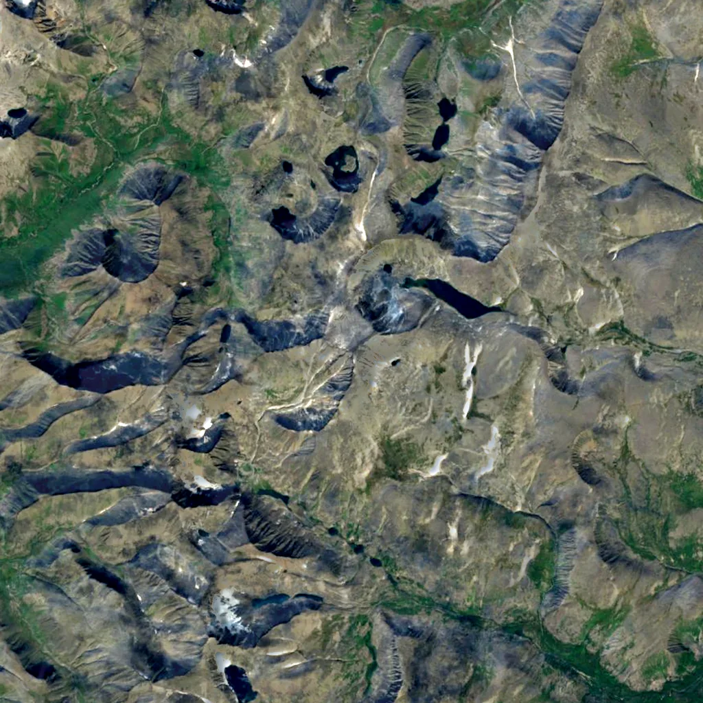
Counted around the summit in OpenStreetMap, the map anyone can edit. The satellite plate shows 14 × 14 km.

Mount Narodnaya seen from above (Sentinel-2) N 5 km

Sentinel-2 cloudless 2016 (EOX, CC BY 4.0), 14 × 14 km, north up. Points © OpenStreetMap contributors.

  • —mountain huts and shelters
  • —cable cars, gondolas, chairlifts and rack railways
  • —ski areas
  • —waymarked hiking routes
  • —via ferratas
  • —climbing crags and routes
  • 5named glaciers

    Манарага, Югра, Манси, Балбан and 1 more

  • 4viewpoints

    Смотровая на Голубое озеро

  • 7campsites

    Стоянка с кострищем, Стоянка and 5 more

  • —hotels, B&Bs and chalets
  • —restaurants and cafés

OpenStreetMap is built by volunteers: a low number may just mean nobody has mapped it yet. Places © OpenStreetMap contributors (ODbL).

Photos

Seen by climbers and visitors

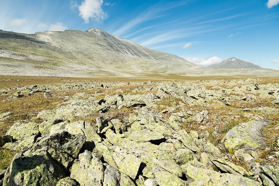
South face of Narodnaya
Bmattlet · CC BY-SA 4.0
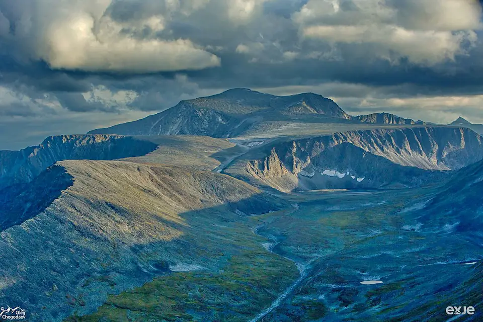
Narodnaya
Oleg Chegodaev · CC BY-SA 4.0

Recent years

How each month compared at the summit

Afternoon high at the summit (estimate). The first row is the reference, the 1991–2020 average in °C; the years show only the difference.

JanFebMarAprMayJunJulAugSepOctNovDec
1991–2020 average-26-25-18-12-7284-3-12-20-23
2020+3.7+6.3+4.0+1.0+1.8−0.9+1.4+0.4+2.0+1.0+2.5−2.2
2021−4.0−6.9−0.7+2.9+2.4+2.5−1.4+1.2−2.3−0.1−1.1−3.1
2022+1.2+4.1−0.7+0.2+0.3+1.8+2.0+3.6−1.3+1.9−0.2−0.7
2023+2.5+3.8+1.0−0.3+2.2−1.2+1.6+3.1+4.7+0.8+1.1−2.2
2024+0.1+1.7−0.5−1.5−4.5−0.9+1.4+2.0+4.1+0.7+3.9+2.9
2025+2.8+3.1+3.5−1.0−1.1−0.4−2.6+3.7+3.1+1.5+0.9−2.0

+1 warmer than usual −1 cooler than usual

In our other atlases

What lies around Mount Narodnaya.

The lakes, waterfalls, rivers, canyons, caves, forests and viewpoints around this mountain, its dark skies and its birds, in the family's atlases.

Figures from the sister sites' databases (Wikidata, HydroATLAS, GeoNames, OpenStreetMap, GBIF). Links open when each site is online.

About these numbers

Names, elevation, prominenceWikidata (Q1142817) · CC0
Relief, 3D view, profilesCopernicus DEM GLO-30 · © DLR e.V., © Airbus Defence and Space GmbH, Copernicus/ESA
ClimateNASA POWER, 1991–2020 · CC BY 4.0
Around the mountain© OpenStreetMap contributors · ODbL
ImagesEOX Sentinel-2 cloudless 2016 · CC BY 4.0; Wikimedia Commons
Sister atlasesViewyas, Forestyas, Darkskyas

Every figure is an average, an estimate or a count from a public dataset. Licences and methods: data sources.

The family

Do you prefer beaches, lakes, mountains, waterfalls, islands, rivers, canyons, caves, dark skies, viewpoints, birdwatching, forests or history?

Same idea, other landscapes: field atlases built on open data, month by month, in seven languages.